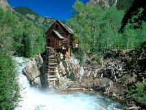
Colorado Mineral Belt
The 250 mile long Colorado Mineral Belt cuts
diagonally across central and southwestern Colorado, in the heart of the
Rocky Mountains. Mt. Elbert (14,431 feet) is the highest of many high peaks
in the belt, all of which were glaciated during the Ice Age. The region
has heavy snowfall in the winter, with mild, pleasant summers.
Placers can be found downstream from many of the mining districts in the Colorado Mineral Belt. The best known placers are those on North Clear Creek west of Denver, at Breckenridge, at Alma and Fairplay, and at Leadville, all of which have been extensively worked. The richest gravels were at Breckenridge, where some 800,000 ounces of placer gold were recovered between 1859 and 1972. Placers in the Leadville area yielded over 350,000 ounces, and North Clear Creek yielded over 300,000 ounces of gold. The Alma-Fairplay placers also yielded around 300,000 ounces of gold. The richest and most productive placer gravels are in the Front Range (northeast) portion of the Colorado Mineral Belt. The bucketline dredge used at Fairplay was the largest in Colorado, and was in service until 1951.
Fairplay
The Fairplay district produced 202,000 ounces
of placer gold, mostly along the South Platte River in the snowstorm and
Fairplay Placers. Along Sacramento and Beaver Creek is excellent placer
ground. The area Southeast of town in glacial out wash gravels contains
placer gold. At the head of Fourmile Creek is the Horseshoe Mine and it
was a good producer. North of Fourmile Creek and south of Mosquito Creek
is the Sacramento Mine that produced a by product of gold.
Alma
The Alma district is located east of Leadville
and had a total production of 1,320,00 ounces of lode gold and 28,000 ounces
of placer gold between 1859-1959. Northeast of Alma about a 1/2 mile, along
the east side of the South Platte River, the placers produced great. Coarse
gold nuggets to several ounces have been found. All the area tributary
creeks and gulches, in gravel deposits contain placer gold. On Mount Lincoln
and Mount Bross, rich area lode mines, especially the London Mine (richest
producer in the county, closed in 1942) produced most of the gold and silver.
Near the head waters of the South Platte River, along the Continental Divide,
on North Star Mountain, all area gulches contain placer gold. Northwest
of Alma, 2~6 miles, many small mines produced lode gold. North of Alma
5~10 miles is the Consolidated Montgomery Mine. This mine is at an altitude
of around 11,000 feet and produced a by product of gold. In Buckskin Gulch,
the Sweethome Mine was a good producer. Around Mosquito creek, all streams
produce placer gold.
BRECKENRIDGE
In the Breckenridge or Blue River district,
including the tipper valley of the Blue River between the Front Range on
the East and the Tenmile Range on the West had a total production of 1,000,000
gold ounces of which 735,000 ounces came from placer deposits. In all regional
stream channels, gulches, benches, etc. you can find placers. East and
northeast of town, in area of about 5 square miles, there are many lead-silver
mines that produced a by-product gold. In Georgia Gulch, on North side
of Farncomb Hill, rich area placers discovered in 1859, area lode mines,
discovered in 1880, especially the Wellington Mine, chief producer, it
was so rich in native gold that pockets supplied collectors and museums
throughout the world with specimens of wire and leaf gold. Along the Swan
and Blue rivers, many deep placers worked by dredges after 1900.
FRISCO
Frisco is located 4 miles southwest of Dillon
and in the Tenmile district. It includes old camps of Kokomo and Robinson
in the Tenmile Valley on the West Side of the Tenmile Range and had a total
production from 1861-1959, of 52,000 gold ounces, mostly as by-product
of base-metal ores. Area old mine dumps contains gold, with galena and
pyrite. Various local small creek placers are around like Kokomo, in McNulty
Gulch, rich placers discovered in 1861, and many mines along valley of
Tenmile creek for 2-3 miles northeast and 5 miles southwest to Robinson.
On East Side of valley, in the Tenmile Range, on West, slopes, many base-metal
mines produced lode gold.
Strasburg
The Gravel and bench deposits along Clear
Creek, just north of Denver contains placer gold. All bars, and benches
along Clear Creek, which is a tributary of the South Platte River, had
extensive placer operations which produced 16,800 ounces of gold between
1922 and 1959.
Along the South Platte River all gravel bars contain placer gold. Also along Cherry Creek, Dry Creek and Cottonwood Creek in T5S R66W and R67W had many productive placer workings. All regional tributary gravels contain placer gold.
Denver
Southwest of Denver in the Holy Cross Mountains,
there are many small mines that produced lode gold. Some placer workings
as well.
Boulder
Northwest of Boulder 3-8 miles is the Gold
Hill Sugarloaf district. This district is about 12 square miles and had
a total production of 412,000 ounces 1859-1959. In the area creek beds,
terraces, benches, etc. you can find placer gold over 3,000 ounces have
been produced. Gold Hill Mine, largest producer, including several adjoining
mines produced lode gold and silver. The old camps of Sugarloaf, Rowena,
Salina, and Sunshine are great places to explore. There are many area mines
that produced lode gold and silver. Southwest of Boulder 4 miles to Magnolia,
reached by steep grades, numerous high-grade mines that produced lode gold
in tellurides. The total production of 130,000 ounces was recorded. West
of Boulder 17 miles and 4 miles Northwest of Nederland, is the Grand Island-Caribou
district in southwest part of county. The Grand Island- Caribou district
had a total production between 1932-59, of 10,006 ounces. There are numerous
area lead-silver mines that produced a by-product of gold. The Cardinal
and Eldora mines are in the area and produced lode gold.
Jamestown
Jamestown is in the Central district. Nine
miles northwest of Boulder there were many area mines. Lefthand Creek,
north of Gold Hill, Bummers Gulch, Coon Trail, North Beaver and South Boulder
Creeks, southeast of Caribou contain placer gold. James Creek above Jamestown
contains placer gold. Central Gulch, west of Jamestown contains placer
gold. Upper Fourmile Creek, northwest of Sugarloaf contains placer gold.
It had a total production of 207,000 gold ounces. There are many area mines
that produced gold in pyrite and telluride minerals. The Jamestown, Gold
Hill and Ward area mines all produced lode gold.
Nederland
North of Nederland on Route 160 toward Ward,
turn east onto the Sugarloaf - Sunset road for 7 miles to the Oregon Mine.
This mine produced gold in sulfide ores.
Ward
The Ward district is 9-13 miles northwest
of Boulder. It covered 12 square miles in headwaters of Lefthand and Fourmile
Creeks. The old camps of Sunset and Copper Rock, more than 50 lode mines
in area, had a total production of 172,000 ounces of lode gold. The Niwot
and Columbia mines were the largest producers of lode gold. In east part
of district, many mines produced gold in tellurides.
Located in the northcentral part of Colorado on the Front Range west of Denver. Clear Creek County ranks seventh among Colorado's gold producing counties, with a total of 2,400,000 ounces coming mainly from lode mines from 1859-1959, with primary production from 1859 to 1864 coming from placer deposits. The main area of interest is in the northcentral part of county 7 miles west by northwest from Central City in Gilpin County. The Alice district extends into Gilpin County and had a total prod production of 23,000 gold ounces from 1883-1959. The Alice Mine was first worked as a placer producer of 2,903 gold ounces then as a lode mine. The North Star-Mann Mine was a producer of 5,610 ounces through 1916 of lode gold.
DAILEY
Daily is near headwaters of West Fork of Clear
Creek and Butler Gulch, 2 miles east and southeast of Jones Pass. There
are many area mines that produced lode gold.
GEORGETOWN-SILVER PLUME
Georgetown / Silver Plume is on U.S. 6 and
40-42 miles west of Denver. The steep grades in this area are treacherous.
Georgetown / Silver Plume is in west part of county. This district consisted
of 25 square miles and had a total production of around 145,000 gold ounces.
Area mines produced a by-product of gold. Southwest of Georgetown / Silver
Plume 6 miles is the Argentine or west Argentine district. Just east of
the Continental Divide, this district had a total production of 25,400
gold ounces. Along Leavenworth Creek, and on the southeast side of Leavenworth
Mountain on the southeast slopes of McClellan Mountain, at head of Leavenworth
Creek, 6 mi. farther southwest, many area mines produced lode and by-product
gold. On Kelso Mountain, area mines produced lode gold. The Belmont Silver
Lode and the Baker Mine were the largest district producers of lode gold.
IDAHO SPRINGS
The best areas to prospect in Elbert County are: Platte River, Gold Run Creek and Ronk Gulch.
Platte River
All Platte River bars and terrace gravels
contain placer gold.
Elizabeth
West and Northwest of Elizabeth 1.5 miles,
along Gold Run Creek and Ronk Gulch on Route 86, about 40 miles southeast
of Denver there are some good gold deposits in the gravels in this area.
Grand Lake
East of Grand Lake 7 miles on route 278, the
area lead silver mines had a by product of gold.
Kauffman Creek
Reported by: Tom Peden
Kaufman Creek is one of the five creeks that
drains from the top of Gravel Mountain. Gravel Mountain, as its name implies
is covered with gravel. Similar to that of Independence Mountain. All five
of these creeks contain gold, but I've only prospected on Kaufman Creek.
The heavy gravels in the bottom of the pan is just like those found on
Independence Mountain. Leads one to think that these gravels are the result
of glacial activity. On my last trip to the area, I found a false bed rock
of conglomerate. With good gold at the contact zone. Have not found any
nuggets, over 1/8", yet. But the area is worth prospecting.
Parshall
South of Parshall, to the head of Williams
Fork, is the La Plata district. It extends a few miles southeast across
Jones Pass on the Continental Divide in the headwaters of the West Fork
of Clear Creek. The lode gold there is often associated with pyrite.
EVERGREEN
Half mile above town, on Cub Creek, small
mines produced lode gold. South 1.5 miles on Route 73 is the Augusta Mine
that produced a by-product gold. Southwest .75 miles on Northwest side
of Cub Creek, along Route 334, and .25 miles Northwest of Route 74, mine
with gold, with fluorite and silver. The Malachite Mine, notable copper
producer by-product gold.
GOLDEN
West, along Clear Creek, to East, many good
placers. Area sand and gravel pits are a source of most gold in recent
years.
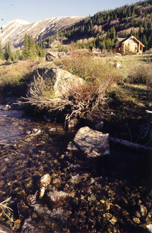
LAKE COUNTY, COLORADO
by: Tom Ashworth
Two of Colorados most important mining areas
are in Lake County, Climax and Leadville. Only Leadville is important in
gold production and accounts for most of its nearly 3,000,000 ounces. Since
almost all of Leadvilles production was a by product of silver, weekend
prospectors have overlooked both Climax and Leadville in favor of the Arkansas
River placers.
Arkansas River
The entire Arkansas River Valley in southern
Lake County has had productive placer locations with some of the better
locations being Box and Lake Creeks and California Gulch. Most of the tributaries
can be counted on to turn in small amounts of placer gold.
Reported By: Greg Ferris
The confluence of the Arkansas River and Lake
Creek area was the general site of some the most extensive and successful
placer mining operations in Colorado. Within a short distance are placer
areas from numerous sources. Some 4 miles upstream from Lake Creek the
Arkansas River is joined by Box Creek and several smaller outlets which
provided source gold from the eastern slopes of Mount Elbert (Colorado's
tallest mountain). This area was extensively worked for a considerable
time period and is generally known as the Derry Ranch Placers. Lake Creek
was a principal contributor of placer gold now found in the Arkansas River,
draining water courses from the southern and southeastern slopes of Mount.
Elbert and adjoining peaks. The majority of the gold originally was accumulated
in moraine deposits, a short (6 mile) drive west on Hwy. 82 into the Twin
Lakes area will quickly demonstrate the glacial valley. These lakes are
now used for the production of hydroelectric power and the saving of fresh
water. Originally the lakes (actually 1 lake) were created by two separate
glacial flows with the end moraines providing the base dam and the upper/lower
lake division. Needless to say with man's "damn" interference, gold no
longer is sorted and fed down into Lake Creek from the glacial gravels.
Just below the dam for a distance of about 3 miles Lake Creek again flows
unimpeded. Dennis O'neil of Balltown, Colo. (a little collection of locals
at the junction of Lake Creek and the Arkansas River) owns numerous claims
on both Lake Creek and the Arkansas River which are open to daily fee users.
Each of the various available claims areas is restricted to different prospecting
methods. The most common activities are high-banking and panning. Dredging
is allowed, by permit from BLM, on the Arkansas River. I have found that
there are some virgin gravels on the Eastside of Lake Creek in the designated
high-banking area but it is tough work as these are packed gravels. It
should be noted that of the gold that is found, like most Colorado placer
gold, it is of the "fine" variety and your prospecting technique requires
care to maximize efforts. Occasionally small pickers and some minor flakes
are found. Black sands are abundant and are filled with microscopic particles
of gold. In this area water must be pumped almost 200' and considerably
uphill. Fortunately you can drive to within 25-50' of the work area. Other
areas are designated "panning only" along Lake Creek banks. On the Arkansas
River, just 100-200 yards downstream from Lake Creek are some good high-banking
areas. These most of these gravels are actually tailings piles from hydralicking
and fluming operations of the late 1800's. The old miners must have only
been interested in the big pieces because there are considerable fines
and flakes to be found. Access is also easy by parking by State Hwy. 24
and crossing over railroad tracks to work area. Water access is also easier
here although attention must be paid to fluctuating water levels as the
hydroelectric operations on Twin Lakes can allow or stop large volumes
of water in very short periods. I have discovered no real secret tips for
working the tailings area, just make sure you aren't reworking the tailings
of a "modern" prospector. The previously mentioned high-banker area on
Lake Creek however does have distinct layers to be worked and better finds
can be had for the gambler. As with most of the upper Arkansas River drainage
no matter where you work you will find some success as I have never been
able to run a single pan between the Pan Ark Lodge (Derry Ranch Placers)
all the way down to Salida (50+ miles) without at least finding some color.
Box Creek
Along Box Creek, there was a large dredge
operations for placer gold. Along lower Box Creek there was a most productive
dredging operation.
Climax
Southeast of Climax 1 mile, in the Arkansas
River Valley, 10 to 12 miles northeast of Leadville, is the Alicante Mine.
It produced lode gold in pyrite ore. Four miles farther south, is the Birdseye
Mine on the East side of the valley. It was a base metal mine, with a by
product of gold.
Leadville
Leadville district had a total production
of 2,970,000 ounces of gold. In the area there were many great mines. I
read a few weeks ago that the last mine shut down in Leadville though (Feb.
1999 California Mining Journal). In Iowa and California gulches, there
were some very rich placer mines. The old placer camp of Oro City, is now
a ghost town. You couldn't tell that it once has over 10,000 residents.
There are many placers that have to be worked using high bankers or trommels
in the area.
If
you have a placer bearing spot in Colorado to add to this web
site
![]()
mailto:[email protected]