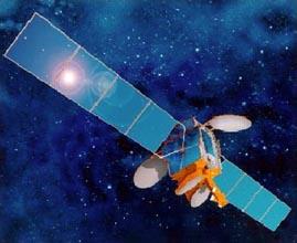
Though not explicitly acknowledged by ISRO, TES is India's first defense satellite. The defense forces will use the satellite for aerial mapping of its borders with China and Pakistan. India had lacked advanced aerial surveillance capabilities, and TES, which is essentially a low-Earth-orbit satellite, will provide much clearer imagery for intelligence use. TES is packed with sophisticated technology like the orbit control system, high torque reaction wheels, reaction control system with optimised thrusters and a single propellant tank, light weight spacecraft structure, solid state recorder, X-band phased array antenna, improved satellite positioning system, miniaturised TTC and power system and, two-mirror-on-axis camera optics. TES also carries a 1 meter resolution
panchromatic camera for remote sensing. The satellite
will be able to pick up movement of troops and even small cars and trucks. ISRO, plans to launch six
additional satellites for military use. The $50 million project is expected to be complete
around 2005. The TES project was conceived in July 1999, following Pakistani intrusions into the Kargil
area of Kashmir State. TES was launched on 22nd October 2001 on PSLV-C3.

