
Trail of Tears State Park
Background Information
Location and Map
Visitor Center Information
Things to Do
Contact Information
Photos
Background:
Southeast Missouri is rich in Native American Heritage.
During President Andrew Jackson's administration, Congress passed the Indian
Removal Act. This act allowed the US Army to move the Cherokee Nation
from Georgia to present day Oklahoma. This movement became known
as the Trail of Tears. The Trail of Tears stretched through southeast
Missouri. Many key events of the trip occurred in our area.
In northern Cape Girardeau County there is the Trail of Tears State Park.A
trip to the area will offer a beautiful and diverse panorama of natural
surroundings. It also will provide a unique glimpse into a brief
but tragic event in our nation's history. Both aspects make a visit
to the park doubly rewarding.
Location:
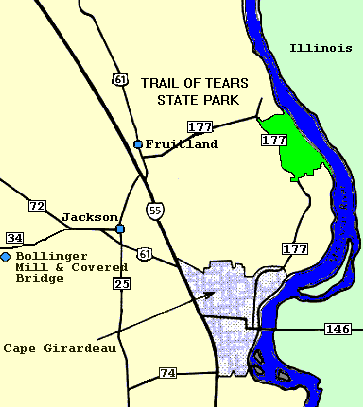
Here is a detailed map of directions to Trail of Tears
State Park. To print out this map, click "Print" at the top of the
toolbar.
Visitor Center Information:
April thru September open daily
Mon - Sat - 9:00 am to 5:00 pm, Sun - 12:00 to
5:00 pm
October thru March open Fri - Sun
Fri - Sat - 10:00 am to 4:00 pm, Sun - 12:00 noon
to 4:00 pm
Return to the top
Things to Do:
-
Camping
-
Hiking
-
Picnics
-
Magnificent View Overlooking Mississippi River
-
Swimming at Boutin Lake
-
Scenic Drives
-
Horseback Riding
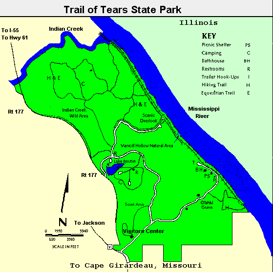
Here is a map of the park with all the various points
highlighted.
 Return to top
Contact Information:
Trail of Tears State Park
429 Moccasin Springs
Jackson, MO 63755
573 334-1711
Photos:
Here are some photos from the Trail of Tears State Park.
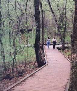
This is one of the trails to hike.
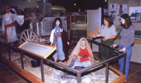
This is a shot from inside the musuem at the Trail of Tears.

Boutin Lake


Last edited: July 8, 2000.
Copyright © 2000.

Email: [email protected]