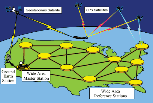
| This is where most of the satellites are in this world. They are on top in space. Like if you want to get somewhere they tell you how to get there. They have some kind of electric thing, to transmit the messages for you to get to the place you want to get to. They can be used for cars all around the world. It is like that is how we get cable from the tv so we can see all the other channels. This is just where all of the Satellites are at.The satellites are here so you can use it on the boats when they are in the ocean. |