 |
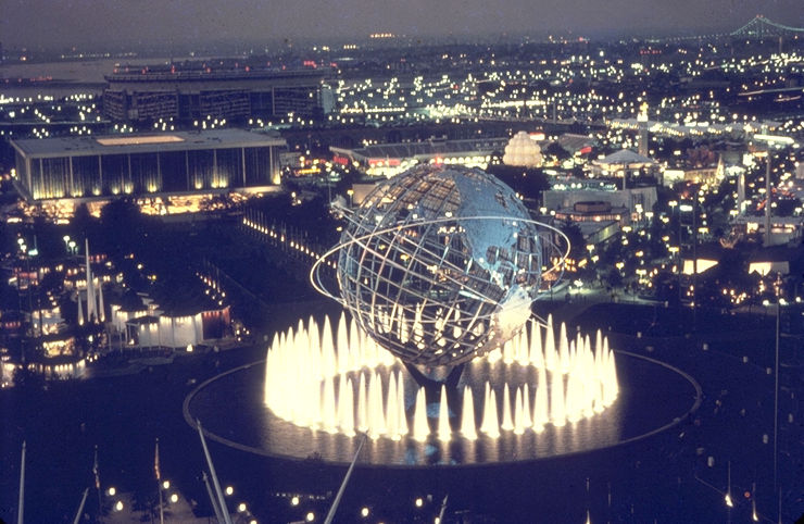
| This is a photo from the 64/65 Worlds Fair. The reason Im showing this is because the bike track (velodrome) was built for it. If you look on top of the photo you can see Shea Stadium. It was brand new back then. |
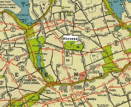 |
| This is a road map of Queens New York in 1941.You can clearly see the park,lake and golf course (58). Below it in red (25D) is Worlds Fair Blvd. now called the Long Island Expressway. |
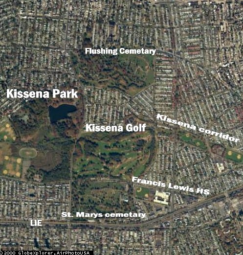
| This is a photo of Kissena Park and its surroundings from the air. The top is north,you can see Flushing cecmetary. South at the bottom is the LIE or LONG Island Expressway. It goes east to west. St. Marys cemetary and Francis Lewis HS.(my old school). Above that is the Golf course and next to it Kissena corridor. |
 |