Physical
- Abaco and Cays island group, c.780 sq mi (2,020 sq km), most northerly of the Bahamas. It includes Great Abaco (the largest), Little Abaco, and the surrounding cays. The low islands, composed mainly of coral...
- Amazon Port. Amazonas , world's second longest river, c.3,900 mi (6,280 km) long, formed by the junction in N Peru's Andes Mts. of two major headstreams, the Ucayali and the shorter Marañón...
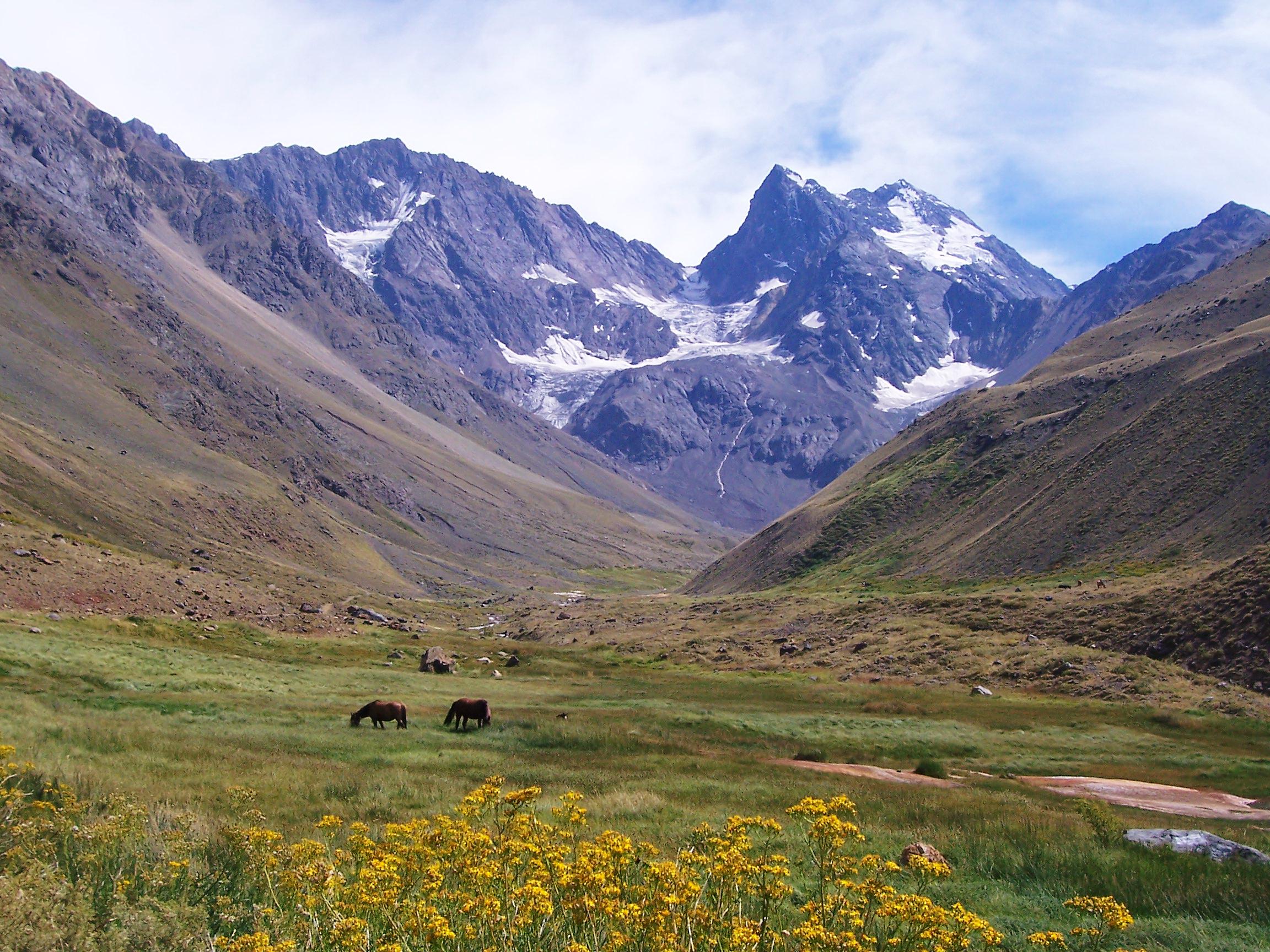
- Andes mountain system, more than 5,000 mi (8,000 km) long, W South America. The ranges run generally parallel to the Pacific coast and extend from Tierra del Fuego northward, across the equator, as the...
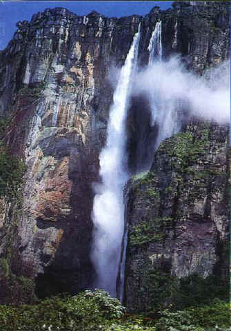
- Angel Falls waterfall, Sp. Salto Ángel, 3,212 ft (979 m) high, SE Venezuela, in the Guiana Highlands. Springing from Auyán-Tepuí Mesa, it is the highest uninterrupted waterfall in the world....
- Apurímac river, c.430 mi (690 km) long, rising in the Andes, S Peru. It flows generally northwest in a narrow valley. After joining the Mantaro River, the Apurímac becomes the Ene; after joining the Perené...
- Apure river, c.500 mi (800 km) long, rising in the Andes, N Colombia, and flowing E across W central Venezuela to the Orinoco River. It drains much of the western portion of the Orinoco basin and is...
- Atacama Desert arid region, c.600 mi (970 km) long, N Chile, extending south from the border of Peru. The desert itself, c.2,000 ft (610 m) above sea level, is a series of dry salt basins flanked on the W by the...
- Atitlán volcanic lake, 53 sq mi (137 sq km), 17 mi (27.3 km) long and 11 mi (17.7 km) wide, SW Guatemala. One of the most magnificent lakes of Central America, it is set among lofty mountains with three
- Bío-Bío river, c.240 mi (390 km) long, rising in the Andes of central Chile and flowing NW to the Pacific Ocean near Concepción. It forms a natural divide between middle and southern Chile.
- Balsas, Río river, c.450 mi (720 km) long, rising in the state of Puebla, E central Mexico. One of Mexico's longest rivers, it flows in a curve from south to northwest through Puebla and Guerrero states,...
- Beni river, c.1,000 mi (1,600 km) long, rising in the Cordillera Real in Bolivia, flowing NE through the Andean hills. It joins with the Mamoré to form the Madeira River. Steam navigation is possible...
- Catoche, Cape extremity of Yucatán peninsula, SE Mexico. It was the first Mexican land seen by the Spanish (1517).
- Cauto longest river in Cuba, c.213 mi (343 km) long, rising in the Sierra Maestra. It flows NW and W to the Caribbean Sea just N of Manzanillo.
- Central America narrow, southernmost region (c.202,200 sq mi/523,698 sq km) of North America, linked to South America at Colombia. It separates the Caribbean from the Pacific.
- Chapala lake, c.50 mi (80 km) long and 8 mi (12.8 km) wide, W Mexico, in Jalisco and Michoacán states. It is the largest lake in Mexico.
- Chimborazo inactive volcano, 20,577 ft (6,272 m) high, central Ecuador; the highest in Ecuador. Its summit is always snowcapped.
- Colorado river, c.550 mi (885 km) long, rising from tributaries in the Andes and flowing SE across S central Argentina to the Atlantic Ocean. It marks the northern limit of Patagonia.
- Cotopaxi active volcano, 19,347 ft (5,897 m) high, N central Ecuador. A symmetrical snowcapped cone in the Andes, it is one of the highest volcanoes in the world.
- Izalco volcano, 7,828 ft (2,386 m) high, W El Salvador. It was sometimes called the Lighthouse of the Pacific because it was visible to 19th-century navigators off the coast. .
- Kaieteur Falls waterfall, 741 ft (226 m) high, in the Potaro River, W Guyana. It plunges over an escarpment of the Guyana Highlands.
- Loa longest river of Chile, 275 mi (443 km) long, flowing S from the Andes, N Chile, then W and N through the Atacama Desert, before turning W to the Pacific Ocean.
- Maracaibo, Lake largest lake of South America, c.5,100 sq mi (13,210 sq km), NW Venezuela, extending c.110 mi (180 km) inland. A strait, 34 mi (55 km) long, connects it with the Gulf of Venezuela. Discovered in.
- Nicaragua, Lake 3,089 sq mi (8,001 sq km), c.100 mi (160 km) long and up to 45 mi (72 km) wide, SW Nicaragua; the largest lake of Central America. It is drained into the Caribbean Sea by the San Juan River. Lake.
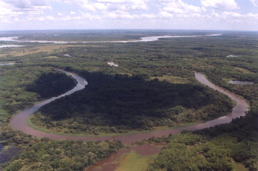
- Paraguay river, c.1,300 mi (2,090 km) long, rising in the highlands of central Mato Grosso state, Brazil. Flowing generally southward, it forms the border between Brazil and Paraguay in the pantanal , then crosses the center of Paraguay, dividing the Gran Chaco from E Paraguay. Two large tributaries, the Pilcomayo and the Bermejo rivers, join it from the west. Below the Pilcomayo, the Paraguay.
- Sierra Madre chief mountain system of Mexico, consisting of the Sierra Madre Oriental, the Sierra Madre Occidental, and the Sierra Madre del Sur and forming the dissected edges of the vast central Mexican
- Sierra Maestra rugged mountain range, SE Cuba, rising abruptly from the coast. Consisting of connecting ranges with local names, the Sierra Maestra is the highest system of Cuba.
- Tacaná volcano, 13,333 ft (4,064 m) high, on the Mexico-Guatemala boundary; second highest peak in Central America. Major eruptions occurred in 1855 and 1878.
- Tajumulco inactive volcano, 13,816 ft (4,211 m) high, W Guatemala. It is the highest mountain in Central America.
- Titicaca lake, c.3,200 sq mi (8,290 sq km), 110 mi (177 km) long, and c.900 ft (270 m) deep at at its deepest point, in the Andes Mts., on the Bolivia-Peru border; second largest freshwater lake in South.
- Turquino peak, 6,560 ft (1,999 m) high, SE Cuba, in the Sierra Maestra range. It is the highest point on the island. The mountain, called Pico Turquino in Spanish, was the scene of intense guerrilla
- Windward Passage strait, c.50 mi (80 km) wide, between Cuba and Haiti, connecting the Atlantic Ocean and Caribbean Sea. It provides a direct route from the E United States to the Panama Canal.
- Xingu river, 1,230 mi (1,979 km) long, rising in central Mato Grosso state, Brazil, and winding north across Pará state into the Amazon River at the head of the Amazon delta. The Xingu, with many rapids
|
|