|
|
GEOGRAPHY
The
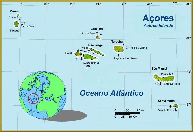
Archipelago of the Azores consists of nine volcanic islands in the North
Atlantic, approximately 1500km from the Portuguese mainland and roughly on
the same latitude as Lisbon. North America is about 3900km further to the
west. The Azores form the western border of the European Union, and the tiny
island of Flores is the westernmost point of Europe. The tips of undersea
volcanos, the islands of the archipelago lie on their own tectonic plate.
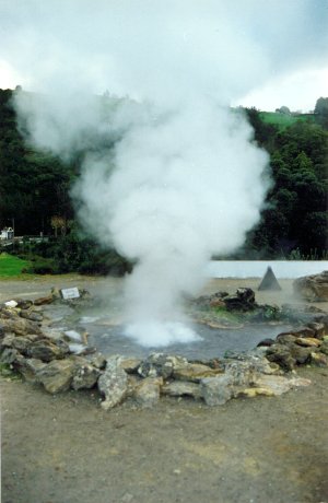
Nowadays there is not much volcanic activity, other than the hot springs and
fumaroles (furnas) found on most of the islands. Off the shore of
Faial there is still some deep-sea volcanic activity near Capelinhos, but it
poses no danger to the inhabitants.
|
|
|
|
The islands are divided into three groups, based on their geographic
distribution. In the east São Miguel and Santa Maria form the Grupo
Oriental - the eastern group, while the Grupo Central consists of
Terceira, São Jorge, Graçiosa, Pico and Faial. Corvo and Flores form the Grupo
Occidental, the western group. The minimum distance between islands is
6km (between Pico and Faial) and the maximum, about 600km, is between Santa
Maria and Corvo.
|
|
|
|
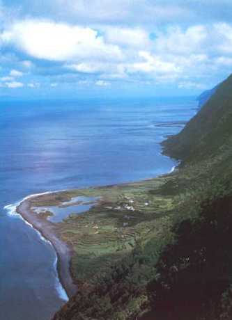
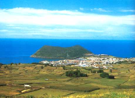
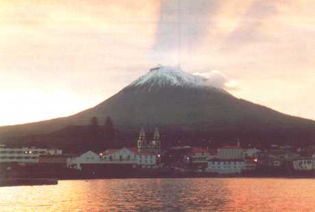
The
highest mountain peak in Portugal is that of Pico (2 351m) on the island
of the same name. All the islands are of volcanic origin and the
predominant rock is therefore basalt. Hence also the grey-brown beaches.
The only island with white beaches is Santa Maria. Their volcanic past is
still clearly visible on all the islands except Santa Maria and in the
form of the typical conical hills, many caldera lakes and remaining hot
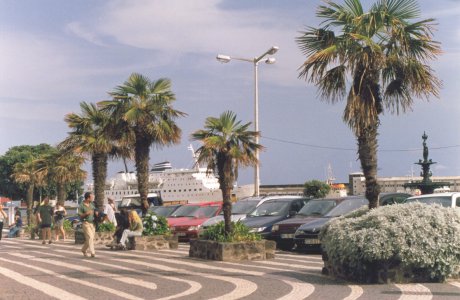
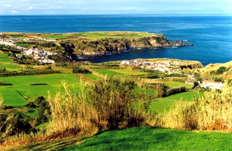
springs. The coastlines vary from steep and rocky to low and marked with
many lovely beaches, the majority of which fly the EU Blue Flag to cerify
that they are safe, clean, well cared for and have all the necessary
amenities.
|
|
|
 |
GOVERNMENT
The
Azores became an Autonomous Region of Portugal in 1976, after the 1975
Portuguese revolution, and is as such responsible for most of its own
governing. The Region has its own President, based in Ponta Delgada, São
Miguel. This is also the seat of the Regional Government. The Regional
Assembly sits in Terceira, where the Minister of the Republic, who
represents the Portuguese Government in the Azores, has his residency.
|
|
|
 |
CLIMATE
Because of its situation, the Archipelago has a moderate maritime climate
characterised by agreeable temperatures which do not vary all that much
during the year. Humidity is high, but barely uncomfortably so, and averages
at around 77% per year. The rainfall is regular and spread over the whole
year, although the winters are somewhat wetter. Temperatures range between
about 13ºC in winter to around 25ºC in summer, although lows as low as
6ºC and highs as high as 30ºC do occur. The ocean temperature ranges
between 14ºC in winter and 24ºC in summer, mostly because the Azores lie
in a branch of the Gulf Stream. There is also a North Atlantic high pressure
system which is called the Azorean High, because it is usually stationed
over or near the islands in summer.
|
|
|
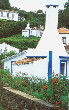 |
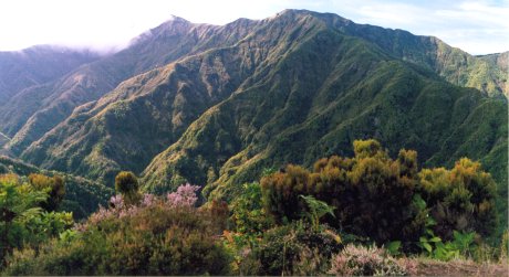
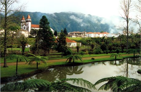
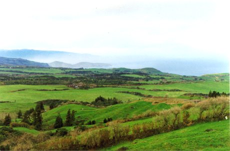
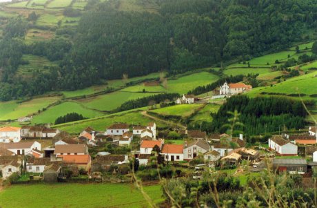
Most of the islands can get fairly misty at times, hence the nickname of
Misty Islands, or Ilhas Brúmosas. It is the climate, the regular,
soft rain and the mists that give the islands their lush, verdant appearance
and make it hard to believe that one is actually in the middle of the
notorious North Atlantic Ocean. Even the waves washing the island shores are
seldom very high or wild.
|
|
|
 |
POPULATION &
ECONOMICS
At the time I was there (2000 - 2001), the Azores had a population of around 260 000,
the majority (53%) of whom lived on the main island of São Miguel.
Corvo at that time had a population of less than 400. Ponta Delgada, the
largest city in the archipelago, had about 70 000 residents.
|
|
|
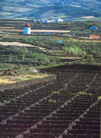 |
The islands' economy
is still mainly agricultural, although fishing remains a major economic
activity. Dairy farming is by far the strongest of the agricultural
sectors. Produce include pineapples, tobacco, maize, potatoes, sugar beet,
passion fruit, kiwi fruit, bananas, tea,(São Miguel is the only place in
Europe where tea
is grown), chicory, wheat, yams, and all the standard vegetable crops.
Oranges are no longer as important an export crop as at the end of the
19th century. Most of the islands have vineyards as well and some
excellent wines are made in the archipelago. The verdelho of Pico
is noted and was a favourite of Czar Nicholas II of Russia.
|
|
|
|
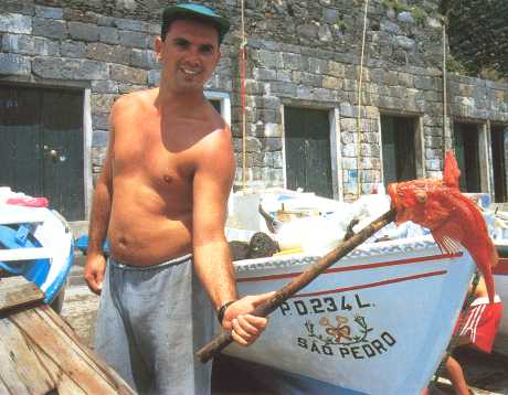
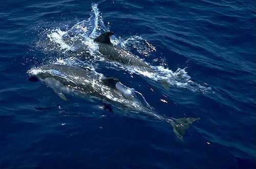
Fishing is still a
very important activity and the tuna caught in Azorean waters is exported
to many European countries. Because of the warm waters of the Gulf Stream,
the archipelago boast a staggering variety of fish species, as well as
most of the main species of game fish. The islands are also noted for
their resident dolphin populations and lie on the migratory route of
whales, especially sperm whales. Whaling was an important industry in the
Central Group in particular until whaling was banned in the latter half of
the 20th century. Today whale watching forms an important part of the
tourism industry of the islands.
|
|
|
 |
Tourism
is only just starting to play a more important role in the Azorean
economy. At the time I left ten more hotels were being planned or under
construction and one hotel group was already flying in 600 Swedish
tourists per week. The Azores is a popular tourist destination for
British, German, Scandinavian and of course mainland Portuguese tourists
especially. Many Americans and Canadians, most of them relatives or
descendants of Azoreans, also visit the islands for the main religious
festivities and the carnival in spring. Nowadays there is more than enough
accommodation available in establishments which range from rooming houses
to five-star hotels and at prices that will suit every pocket.
|
|
|
 |
HISTORY
There is some
uncertainty as to exactly when the islands were first discovered, and some
very old maps show what seem to be indications of the islands. The first
recorded visit, though, is credited to that of the Portuguese navigator
Diego de Silves, who discovered the islands of Santa Maria and São Miguel
in around 1427. On the 15th of August 1432 (the Day of the Ascension of
Our Lady) Gonçalo
Vasco Cabral landed on the island of Santa Maria with a few crew members.
The first settlement on the island was the village of Praia dos Lobos,
founded in 1439.
|
|
|
 |
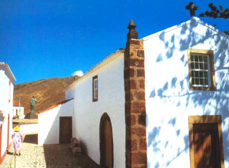
Columbus,
on his return from the West Indies in 1493, stopped off at Santa Maria to
attend mass in the chapel of Our Lady of the Ascension. He was at first
mistaken for a pirate and arrested, but later released once he managed to
convince the Governor who he was.
São Miguel was first
settled in 1444, the settlers -- from mainly the Estremadura, Alto
Alentejo and Algarve areas of Portugal, and France and under the command
of Gonçalo
Velho Cabral -- landing at the site of modern-day Povoação
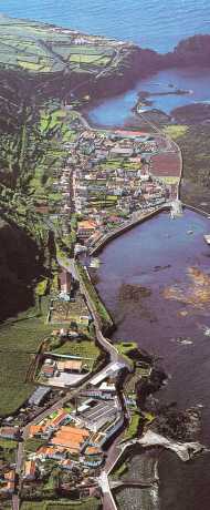
. In 1522 Vila Franca do Campo, then the capital of the island, was
devastated by a landslide caused by an earthquake, and the capital was
moved to Ponta Delgada. The town of Vila Franca was rebuilt on the
original site and today is a thriving fishing and yachting port. Ponta
Delgada received its city status in 1546.
|
|
|
 |
The
third island to be discovered was Terceira (hence the name, which means
"Third"), at first called the Island of Jesus Christ. Settlement
was under the command of the Flemish nobleman Jácome
de Bruges in 1450. An area of 6km² of its capital, Angra Heroísmo, was included in the UNESCO List of World Patrimony in 1983. An
earthquake on January 1, 1980, destroyed a large part of the old city, but
the buildings were restored, using the original materials as far as
possible. Today Terceira is still the most important of the islands after São Miguel.
|
|
|
 |
It
is believed that sailors from neighbouring Terceira, about 31 nautical
miles away, discovered the island of Graciosa circa 1450. Settlement was
under the command of Vasco
Gil Sodré. Columbus's brother-in-law, Pedro Correia da Cunha, was later
granted captaincy of the northern part of Graciosa The first town on the
island, Santa Cruz, received its status in 1486.
Graciosa had many distinguished guests over the centuries: during the
French Revolution the French writer Chateaubriand stopped over here in his
flight to America; the famous Portuguese poet Almeida Garrett, and Prince
Albert of Monaco, who led several oceanographic expeditions here aboard
his yacht Hirondelle in the 19th century.
|
|
|
 |
São
Jorge is first mentioned in 1439, but the actual date of the discovery is
unknown. The island was already inhabited by 1443., although active
settlement only began with the arrival of the Flemish nobleman Wilhelm van
der Haegen, who became known as Guilherme da Silveira to the islanders.
Velas became a town just before the end of the 15th century.
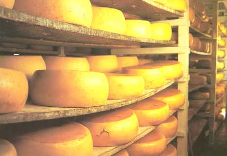
Today
São
Jorge is especially famous for its delicious cheese, which is exported to
Europe and the United States.
|
|
|
|
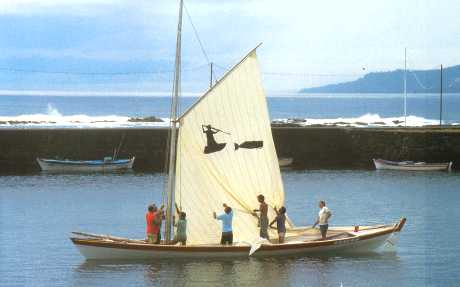
Pico
was first settled in about 1460 at Lajes. The Verdelho do Pico is a
famous red wine made here and loved by the czars of Russia. Later sperm
whaling became a major industry. São
Roque
achieved its townhood in 1542, and Madalena in 1723.
|
|
|
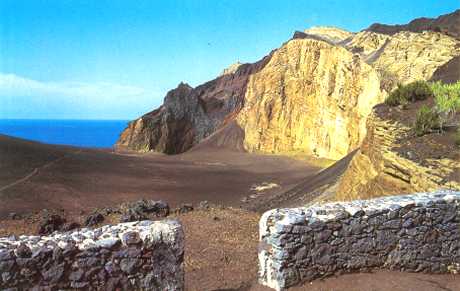 |
Faial,
originally marked as Insule de Venture on old maps, was already
settled by 1460. In 1468 the Flemish nobleman Josse Van Huerter was
granted jurisdiction over the island to which he had brought many of his
countrymen and the area where they settled soon became known as Vale dos
Flamengos (Valley of the Flemish). Faial suffered one of the last major
volcanic eruptions when in 1957 the volcano at Capelinhos erupted, adding
2,42 km² of land to the western end of the island. The volcano remained
active for 13 months and spewed millions of tonnes of black ash on the
island. No lives were lost and there was minimal damage to property.
|
|
|
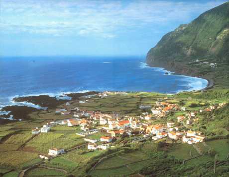 |
Flores,
the Island of Flowers, was discovered in 1452 or thereabouts by Diego de
Tieve and his son João
de Tieve and was initially known as St Thomas and St Iria. The many
yellow flowers (cubres), however, led to the name being changed.
The island was settled by Wilhelm van der Haegen in 1470, but the
distance from the other islands and the lack of transport for the pastel
dyes made him abandon the island to go to São
Jorge instead. The town of Fajã
Grande
on the island has the distinction of being the westernmost town in all
Europe.
|
|
|
 |
Corvo,
with a surface area of only 17 km², is the smallest of the islands and
was discovered by de Tieve and his son around 1452. The island was long
known as Insula Corvi Marini. This tiny island supplied a multitude
of whalermen for the New England whalers and these Corvians were renowned
for their bravery. |
|
|
 |
Over
the years many Azoreans left their island shores to seek fame and fortune
in countries like the USA, Canada and others. They never really
managed to leave their island roots behind, though, and try to return as
often as possible to renew family ties and to bring their children to
their ancestral homes.
The
Azores have long been a special favourite among yachtsmen, and the marinas
of Horta (Faial) and the Clube Naval in Ponta Delgada are usually hosts to
a multitude of yachts from all over the globe. With the opening in 2002 of
the new marina in Vila Franca do Campo (São Miguel) yachtsmen
will have yet another safe and welcoming haven in these wonderful
isles.
|
|
|
 |
This,
then, is a brief overview of the islands of the Azores. I hope that you
enjoyed learning more about this beautiful little corner of paradise where
I was so happy. There is so much more to be told about these islands, but
sadly not enough space here. |
|