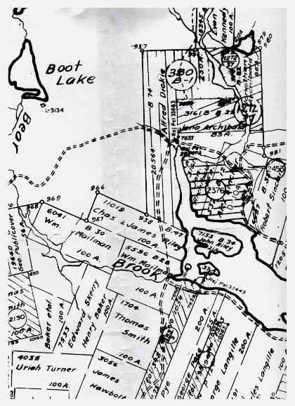
| The grant map to the right is a section from Liscomb Mills, NS. The large river running in the the Liscomb Harbour is the Liscomb River. At the mouth of the Liscomb River is the Liscomb Lodge. The Highway passing the lodge and continueing along the shore is the #7 Highway. At Bear Brook, on Wm. Mailman's property, it branches to continue along the shore. This is called the West Liscomb Road. The road running in to no-man's land and under Boot Lake is an old farm road. At one time there was a farm house there, but it is long gone. |