Satellite Exploration of Thailand > Projects
|
Quote: Living in hope "It all began with the building of the Khao Laem dam which drowned our home villages," Didi's assistant, Weerawan Polthip, recalls bitterly. Before the dam, she said, the Karen communities were closely tied by kinship and blessed with rich nature. "We never went hungry as there was plenty of food from our farms and forests. The streams were full of fish. If we had problems, we always have relatives to help out. Now no more." The Khao Laem dam drowned their valley homes and ancestral farms in the mid 1980s. Some people got meager compensation, others got none at all. Everyone had to move up the rugged hills where their soil was poor and rocky. This was the ground on which they had to build a new life. "Many people could not wait for the trees to grow, they sold their land to investors from the towns, and the able-bodied left to work outside the villages. Families can no longer live together," Ms Weerawan said. With the breakdown of social control, Ms Weerawan said, there began the phenomenon of young men leaving their wives and children at a whim. The young mothers, with no family kinship to support them as might have existed in the past, were often forced to leave home to work too. Many became prostitutes, some became infected with the Aids virus. The result is a rising number of Aids patients and orphans in the village. Meanwhile, poor medical care means malaria continues to be the main killer in the area, with orphans left to struggle in a culturally disintegrated community with few social support networks. "These children would have had relatives to care for them before our home village was drowned," says Ms Weerawan. |
|
Quote: Watershed Vol.6 No.1 July - October 2000: Marginalising the Local Of the 1,949 families that were forced to move to the resettlement site, 20 per cent had moved again by 1989. As many as one in five of the ethnic minority Karen villagers living in the 388 square kilometre reservoir area before the dam was built had no legal residence papers and were therefore ineligible for houses at the resettlement site. The World Bank thus ignored them. According to a study produced by the World Bank's Operations Evaluations Department in 1993, 80 per cent of people evicted by the dam "were...dissatisfied with the resettlement outcome", considering themselves "to be worse off than before resettlement". The area between the nearby town of Kanchanburi and the dam was forested before access roads to the dam were built. Since the dam was completed, forest has been cleared for golf courses, tourist resorts, commercial agriculture, plantations, transmission lines and more roads. Panya Kwanprasertwaree, a Karen elder who was forced to move because of the dam, told Watershed magazine, "We had to spend all of our compensation for living, and it wasn't enough, actually. The water supply that they talked about never happened...The condition of the land here and my previous land is very different...I miss the fertile resources. Everything was fertile. I could find things for a meal. The thing that I miss most is rice. Rice is my soul. Our ancestors did rice farming for ages. But now I cannot grow rice and have to buy it, which is also very expensive ... If I could ask the officials for one thing, I would like to ask, 'Please can I return to where I was?'" |
Quote: Beyond the Kwai
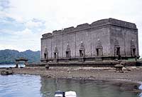
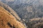
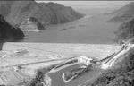
From there we took a boat to tour sites unlike any other I have seen before. We reached Samprasob, the point where Songalia, Rantee and Beeklee rivers meet. The confluence of the three rivers had led to the creation of a huge artificial reservoir following the construction of Khao Lam dam in 1983. We proceeded to visit what is left of the original bridge built during the Second World War to link Thailand with Burma. You can only see the remains of the original bridge if the water level in the reservoir is low during the summer season. From there we proceeded on the most unsual leg of our journey to Sangkhla Buri, a district bordering Burma that is blessed with some of the most spectacular views of mountains, forests and natural landscape in the country, and a settlement of ethnic Mons and Karens that lies submerged in water following the construction of Khao Lam Dam. We reached Muang Badaan, the local name for the submerged settlement. During March to May when the water level is low you can see old houses, temples and a hospital, or whatever is left of them today, that belonged to ethnic Mon and Karen hilltribesmen who once lived there, but were forced to move to higher ground after the government decided to build the dam. Watching this lost settlement, a monument to once thriving Mon and Karen cultures on the Thai-Burmese border, can leave a bad taste, but nonetheless, the view of the gigantic reservoir with boats and rafts plying the lake make for a stunning spectacle. "It gives me a sad feeling watching the lost villages and temples,"said Poo, a local resident. |
|
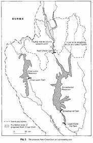
Stage I: Construction of Vajiralongkorn Diversion Dam and distribution system over the area of 1,000,000 rai on the lower left bank of Mae Klong during 1964-1975 Stage II: Construction of Srinagarind Storage Dam and Tha Thung Na Regulating Dam on Khwae Yai and distribution system on the upper left bank and the right bank of Mae Klong over the area of 1,600,000 rai during 1970-1989. However, the construction of distribution system on some part of the upper left bank is delayed and continued in stage III Stage III: Construction of Khao Laem Storage Dam on Khwae Noi during 1979-1984. Bang Laen irrigation project on the upper left bank which could not be completed in stage II, are continued in this stage. It is planned that the construction of Banglane project be completed by year 2,000 Stage IV: Construction of Nam Choan Storage Dam on the Upper Khwae Yai. The study for this plan was started in 1970. However the plan was suspended because of the objection on environmental impact of the dam. |
||||||||||||||||||||||||||||||||||||||||||||||||||
|
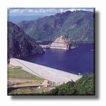
Si Nakharin Dam H: 140m / W: 610m |
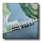
Tha Thung Na Dam H: 30m / W: 840m |
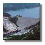
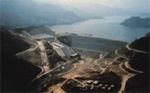
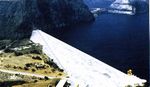
Khao Laem Dam H: 92m / W: 1019m |
Nam Chon Dam H: 185m / W: 400m |
 |  |  |  |
 |  |  | |
 |
| Name of the Dam | Location | River | Completion |
| Bhumiphol | Tak | Ping | 1964 |
| Nam Phung | Sakon Nakorn | Phung | 1965 |
| Ubon Ratana | Khon Kaen | Phong | 1966 |
| Sirinthon | Ubon Ratchathani | Dom Noi | 1970 |
| Nam Phrom | Chaiyaphum | Phrom | 1973 |
| Sirikit | Uttaradit | Nan | 1974 |
| Si Nakharin | Kanchanaburi | Kwae Yai | 1980 |
| Bang Lang | Yala | Pattani | 1982 |
| Tha Thung Na | Kanchanaburi | Kwae Yai | 1982 |
| Khao Laem | Kanchanaburi | Kwae Noi | 1984 |
|
Resettlement of Population Following the Dam Consruction: The Case of Srinagarind Dam, Thailand 1981, Manat Suwan, 209 pages |
|
Report on a Socio-economic Study of the Villages in the Proposed Reservoir Area of Electricity Generating Authority of Thailand's Project (Khao Laem Dam) 1979, Chulalongkorn Univbersity Social Research Institute, 153 pages |
|
Series / Nam Choan Inquiry 1988, Nation, 27 pages |
| Path | Row | WRS | Sensor | RGB | Date | |
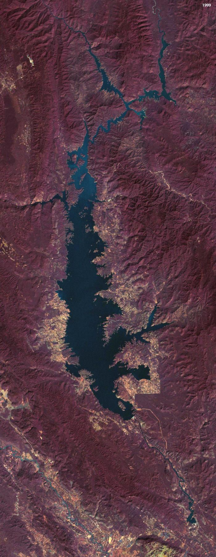
| Image-1 | 140 | 50 | 1 | MSS | 231 | Jan 26, 1973 |
| Image-2 | 131 | 49 | 2 | ETM+ | 732 | Feb 02, 2000 |
| Image-3 | 131 | 50 | 2 | ETM+ | 732 | Feb 02, 2000 |
| Image-4 | 130 | 50 | 2 | ETM+ | 732 | Dec 25, 1999 |
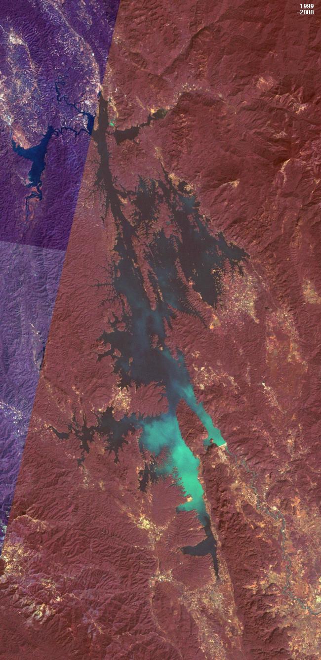
I chose the color combination RGB=732 (rather than 742) for ETM+ images to allow higher contrast for roads and cities.
Making of a mosaic (Image-2, Image-3, Image-4)
Image-2 and Image-3 are sequential frames from the same Landsat mission, and they can be stitched pixel-to-pixel. Their color balances somewhat differ, though. Image-4 is from another mission and, due to the peripheral aberration, difficult to stitch to Mosaic-2-3 with high precision. I did not perform color matching, but "stretched contrast (graphic editor: GIMP)."
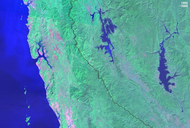
For the 1999-2000 overview picture of Kanchanaburi and Burma, I composed a mosaic from 1/8 frames (RBG=742) and performed color matching.
The Thai-Burmese border demarcation line was adopted and overlayed from the CD map "SmartMap / Thailand."
Matching of Image-1 and Mosaic-2-3-4
| Image-1 |
1. I magnified its height by 3220/3200 (= 1.006250). 2. I rotated the image 8.86o clockwise. |
| Mosaic-2-3-4 | 1. I magnified the image (both width and height) by 750/1420 (= 0.528169) |
Due to peripheral aberration, the matching process was difficult and its outcome unsatisfactory.