
 |
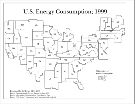
The cartogram is illustrated so that the interior units are proportional to the data they represent. I used grid paper to calculate the units for each given state. Then I scanned the map into Adobe Illustrator to produce a digital graphic of the cartogram. |