![](http://www.geocities.com/clipart/pbi/c.gif) |
|
|
![forest cover at the base of cedars](forest1.jpg) |
|
|
|
![Douglas firs over look the beach](rockface.JPG) |
|
|
|
Wet, mild winters are optimal for growth in the region around Sombrio. 
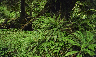
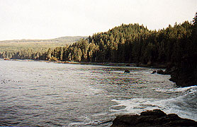
Sitka spruce, western hemlock, red cedars, and Douglas fir dominate the coastal forest. 
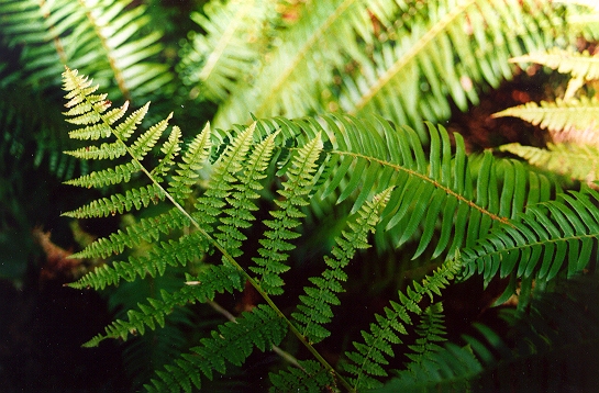
(pictured left with sword fern) |
|
|
|
|
|
|
Vegetation |
|
|
|
|
|
|
|
![a young cone](douglasfir.jpg) |
|
|
|
|
|
|
|
|
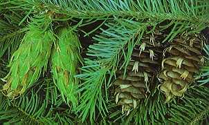
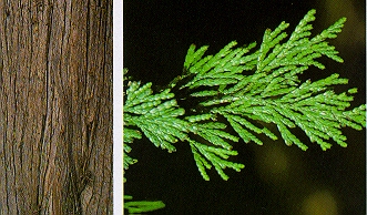
Douglas fir is both left and right. The distinguishing oval cone bristles of Douglas fir, have 3-pronged bracts that can reach upto 4inches in length. The dark green lusterless needles appear in a 'bottle-brush' array. |
|
|
|
|
|
|
|
|
|
![an oak fern in the swords](fern.jpg) |
|
|
|
An oak fern grows in the forefront of this picture. Smaller than most other ferns at 6 to 10 inches, the oak fern forms rampant patches beneath the forest canopy.
In the background is a majestic sword fern. Whose fronds by comparison reach 3 to 5 feet in length, growing from massive clumps of up to a hundred long arching fronds. |
|
|
|
|
|
![red cedar over hangs the cliff](clifftrees.JPG) |
|
![bark and leaf of red cedar](redcedar.jpg) |
|
|
|
The red cedar is the most common cedar in the coastal forest. It is easily identified by small elongated cones and a sweet (chamomile) odor to its foliage. Less imposing than the taller western hemlock or Douglas fir, its lower limbs often trace a graceful s-shaped curve. |
|
|
|
|
|
|
|
|
![a fern, a horsetail, and salal](drops.JPG) |
|
|
In the foreground a horsetail catches the morning dew. A perennial plant, it rises from a creeping root underground. The small whorled leaves gives this plant a segmented look. It was often used by natives to scour pots and polish hardwoods.
The robust evergreen, salal, crowds the back ground and is found nearly everywhere on the island. The purplish berries are nutritous but bland, and are highly prized by coastal natives. |
|
|
|
|
![tides surge through the seaweed and rocks](waves.JPG) |
|
|
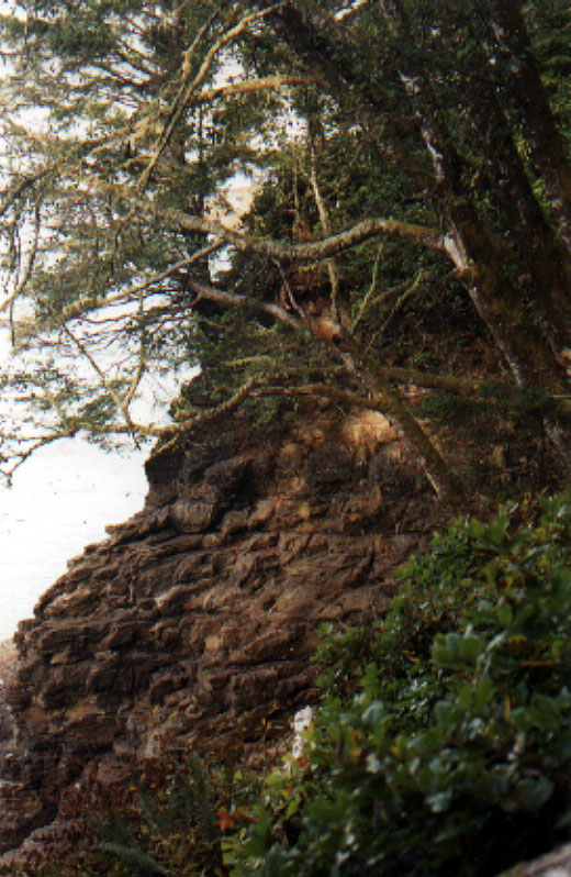
The towering coastal forest opens onto the vista of the beach. |
|
|
|
|
|
![Sombrio from above the caves](ocean3.JPG) |
|
|
|
|
|
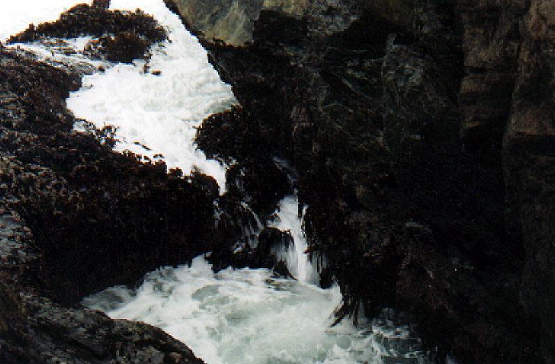
On the right, the ocean carves its way into the cliff face. Fucca, commonly called popper, and red seaweed cling tightly to the rock; thier hold fasts (root-like structures) enable them to survive the surging tides. |
|
|
|
|
|
|
![Back to TOP](http://www.geocities.com/clipart/pbi/bullets/Templates/4DiamondBlueBullet.gif) |
|
![Next to Wildlife](http://www.geocities.com/clipart/pbi/buttons/Generic/next1.gif) |
|
|
![Back to History](http://www.geocities.com/clipart/pbi/buttons/Generic/back2.gif) |
|
|
|
|
|
|
|
|
|
|
![Back to Home](http://www.geocities.com/clipart/pbi/buttons/Templates/AlbumPinkHomeBtn.gif) |
|
|
|
Beach Life |
|
|
|
Maps & Links |
|
|
|
|
|
History |
|
|
|
Photogallery |
|
|
|
|
|
Wildlife |
|
|
|
Survival |
|
|
|
|
|
Tourism |
|
|
![](http://geo.yahoo.com/serv?s=76000026&t=944784059) |
|