page last updated August 2004.
Welcome to the Geology of Trinidad....
BACK
Geological Map
PICTURES
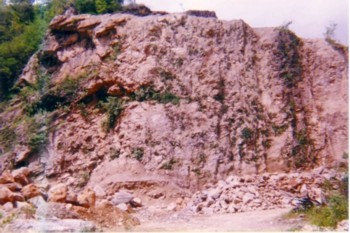
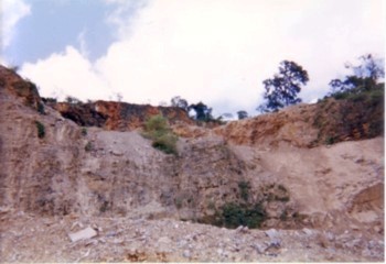
This image taken at a quarry shows the intense faulting of the Northern Range. The
western tip of the mountain surface shows the rocks dipping downwards.
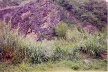
The above picture {located in the Northern Range} displays the folding of rock layers.
This type of fold is an anticline.
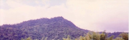
This block of mountain has been thrust upwards by faulting. The outline of the mountain
reveals evidence of folding. This is part of the mountain system that extends all the way across
Trinidad and the northern tip of Venezuela.
Many of these rocks are from the Jurassic to Pleistocene epoch. This rock structure is of
limestone and metamorphic origin.
HOME
|
|
|
TOBAGO GEOLOGY
BARBADOS GEOLOGY
ZOO ZONE
Pictures
Fossils
W.I. Geology