JHELUM RIVER KEY FACTS
Length of River Jhelum in Pakistan: 379 miles Important Engineering Mangla Dam, Rasul Barrage (850,000 Structures on the River: cusecs) and Trimmu Barrage (645,000 cusecs) - at the confluence of River Chenab Catchment Area: 21,359 miles2Annual Average Flow: 11.85 MAF (8.2 kharif and 3.65 rabi) 1.0 RIVER FLOW PATTERN The Jhelum is a large eastern tributary of the Indus.
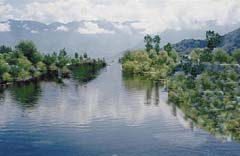
It drains areas west of Pir Panjal separating Jammu and Kashmir. The Jhelum rises from the spring of Verinag, on the northwestern side of Pir Panjal and flows in a direction parallel to the Indus at an average elevation of 5,500 feet. It drains about 2,300 square miles of alluvial lands in the Kashmir Valley and gets water from various important sources including glaciers located in the north of the valley.
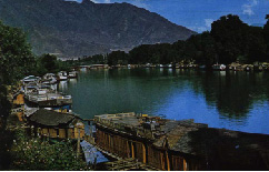
The river first flows through Dal Lake and then an even bigger lake - Wular Lake, into which it drops coarse grades of sediment. On emergence from the Wular Lake near Baramula, it runs through an eighty-mile long gorge at an average slope of 33 feet per mile. At Domel, near Muzaffarabad, the river is joined by its largest tributary, Neelum (earlier called the Kishan Ganga), which drains about 2800 square miles of hilly area lying on the eastern side of the Nanga Parbat. The Neelum drains Himalayan ranges between 15,000 to 20,000 feet high that are perpetually covered by snow and glaciers. In the lower reaches, the 150-mile long river flows through mountainous country covered by forests.
Five miles below the Domel, the Kunhar, another tributary, joins the River Jhelum, draining nearly 1,080 square miles of the famous Kaghan Valley. Sources of River Kunar lie at about 15,000 to 17,000 feet above sea level. 80 of its total length of about a 100 miles are situated in the hills where it falls at nearly 120 feet per mile, forming innumerable rapids and flowing through the Lalusar Lake. One of Kunar�s tributaries also flows through the famous Saif-ul-Molook Lake.
From Domel to Mangla, a distance of about 90 miles, two streams, the Kanshi and Poonch join the River Jhelum. The Kanshi is a floodwater stream draining eroded areas of the Jhelum and Rawalpindi districts. This stream carries mainly monsoon rain or seepage water. The Poonch is an important stream joining the Jhelum at Tangrot, about seven miles above Mangla. The site where the two rivers meet used to be a famous fishing spot but now lies within the storage area of the Mangla Dam. The Poonch drains the southern sides of Pir Panjal, which ranges between 10,000 to 12,000 feet in height and becomes snow bound during winter. Its catchment area of 1,520 sq. miles is partly covered by forests. The river flows through hilly country for its entire length of 80 miles and drains the areas of Poonch, Kotli and Mirpur.
The Mangla Dam has been constructed near the head regulator of Upper Jhelum Canal. From Mangla down to Rasul, several floodwater streams drain into the Jhelum. The Kahan Nullah is nearly forty miles long and drains the Rohtas area, where an auxiliary storage of Mangla Dam was considered. Suketar, Jaba Kas and Bunha are three of the many floodwater nullahs that drain into the Jhelum, through a level crossing of Upper Jhelum Canal. 2.0.
IMPORTANT TRIBUTARIES AND THEIR CATCHMENT AREAS
Tributary Catchment Area Miles2Discharge (MAF) Sediments (Acre-ft/ year) Neelum 2,600 6.1 5,224 Kunhar 1,080 2.0 2,861 Kanshi Not Available 0.36 293 Poonch 1,520 2.0 5,678 Kahan 470 0.037 425 3.0.
STRUCTURES ON THE JHELUM RIVER
Pakistan Mangla Dam Earthfill dam with a gross storage capacity of 5.88 MAF. Rasul Barrage Constructed in 1967, with a maximum capacity of 850,000 cusecs. Trimmu Barrage Constructed in 1939 and located at the confluence of Chenab with a maximum design discharge of 645,000 cusecs. Upper Jhelum Canal Taken out from Mangla for a design discharge of 221 m3/s. It feeds River Chenab upstream of Khanki barrage. Rasul-Qadirabad (RQ) Link Canal Taken out at Jhelum from Rasul barrage for a design discharge of 538m3/s. It feeds Chenab upstream of Qadirabad barrage. Chashma-Jhelum (CJ) Link Canal Taken out from Chashma Barrage for a design discharge of 615 m3/s. It feeds Jhelum River downstream of Rasul barrage. 4.0 AVERAGE FLOWS IN JHELUM The Indus River System Authority compiles the river flow data.
The annual average flows are calculated by averaging the daily flows. The kharif data represents the April 01 � September 30 period and the rabi data is based on flows between October 01 � March 31 of the following year. Data collected for the Jhelum collected at Mangla for 40 years before the Indus Water Treaty i.e. 1922-61, ten years after the treaty i.e. 1985-95 and recent year completed i.e. 2001-02 depicting drought conditions is as follows: Average Annual Flow (1922-61) MAF Average Annual Flow (1985-95) MAF Average Annual Flow (2001-02) MAF 23 26.6 11.85 5.0
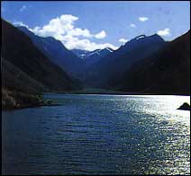
THE WULAR BARRAGE ISSUE
Despite the signing of the 1960 Indus Waters Treaty, another dispute emerged in 1985, when Pakistan learnt through a tender notice in the Indian press about the development of a barrage by the name of Tulbul Navigational Project. The barrage was to be constructed by India on the River Jhelum, below the Wular Lake near Sopore, 25 km north of Srinagar. For Pakistan, the geo-strategic importance of the site lies in the fact that its possession and control provides India with the means to intimidate Pakistan.
A dam on that site has the potential to ruin the entire system of the triple canal project within Pakistan namely, the upper Jhelum Canal, upper Chenab Canal and the lower Bari Doab Canal. Pakistan argues that India violated Article I (11), Article III (4) and sub-paragraph 8(h) of the Indus Waters Treaty. Pakistan referred the Wular Barrage case to the Indus Waters Commission in 1986, which, in 1987, recorded its failure to resolve it. Once India suspended the construction work, Pakistan did not take the case to the International.
|
 You can Click here