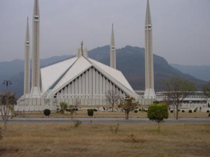
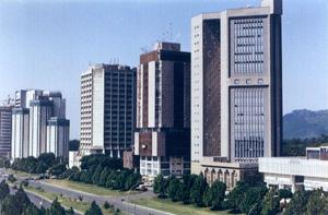
 Islamabad,
Pakistan's capital, nestles against the Margala Hills,
the foothills of the Himalayas in northern Punjab.Technically
it is not part of Punjab, but forms its own Capital
Authority. Modern, spacious and carefully planned,
Islamabad is a city of wide, tree-lined streets, large
houses, elegant public buildings and well organized
bazars. Traffic jams and crowds are rare, and narrow
lanes and slums are few and far between. Sidewalks
are shaded and safe behind rows of flame trees, jacaranda
and hibiscus. Roses, jasmine and bouganvillaea fill
the many parks, and scenic viewpoints show the city
to its best advantage.
Islamabad,
Pakistan's capital, nestles against the Margala Hills,
the foothills of the Himalayas in northern Punjab.Technically
it is not part of Punjab, but forms its own Capital
Authority. Modern, spacious and carefully planned,
Islamabad is a city of wide, tree-lined streets, large
houses, elegant public buildings and well organized
bazars. Traffic jams and crowds are rare, and narrow
lanes and slums are few and far between. Sidewalks
are shaded and safe behind rows of flame trees, jacaranda
and hibiscus. Roses, jasmine and bouganvillaea fill
the many parks, and scenic viewpoints show the city
to its best advantage.
GENERAL INFORMATION
Islamabad is 518 metres above sea level. It is best
from October to March, when the days are crisp and
cool, and the nights are cold. Spring is short, but
the flowers in March are a riot of colour. The hottest
months are May and June, after the monsoon, but even
then the climate is usually not oppressive, and you
can always escape to the hills, 2250 metres above
sea level.
HISTORY
The decision to build Islamabad was taken in 1958
under President Ayub Khan . Karachi, the capital since
Independence in 1947, and Pakistan's largest city
and only port, proved unsatisfactory because of its
distance from many parts of the country and because
of its debilitating climate. Islamabad on the other
hand, offered a healthy climate, plenty of water and
a central position on the Grand Trunk Road, close
to Punjab and North-West Frontier Province. That nearby
Rawalpindi was the headquarters of the Pakistan army
was another consideration. Finally the site had historical
connections because of its proximity to nearby Taxila,
for many centuries the regions main city.
A Greek firm of architects, Doxiadis Associates,
drew up a master plan, triangular in shape based on
a grid system with its apex towards the Margala Hills.
The planners envisaged Islamabad eventually absorbing
Rawalpindi entirely and stretching well to the west
of the GT Road.
The city was divided into eight zones: the diplomatic
enclave , the commercial district, the educational
sector, the industrial area and so on , each with
its own shopping area and park. Construction began
in 1961 and the first residents moved in two years
later. Meanwhile, government offices were temporarily
moved up to Rawalpindi.