|
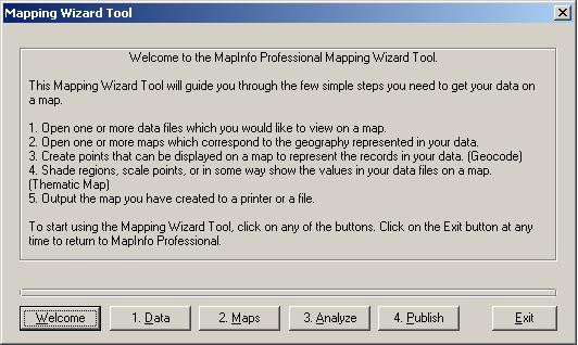
- Welcome: The Mapping Wizard Tool dialog box appears, with a welcome panel explaining in simple terms what the Wizard does. Use the buttons at the bottom of the dialog box to navigate through the Wizard.
|
|
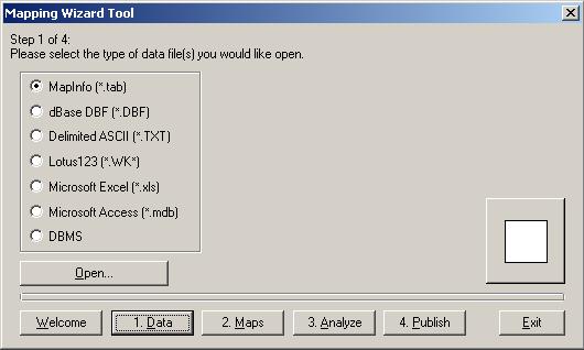
- 1. Data: Allows you to open the table from which you wish to make a map (Section Two, Part Two). You may open MapInfo tables (.tab), dBase files (.dxf), delimited ascii files (.txt), Lotus 123 worksheets (.wk*), Microsoft Excel sheets (.xls), Microsoft Access files (.mdb) or DBMS files.
 DBMS stands for Database Management System. Such systems are often used in GIS. DBMS stands for Database Management System. Such systems are often used in GIS.
- Choose MapInfo (*.tab), and press the Open button. Navigate to the folder where you have saved the table you wish to use, select the table, and press the Open button on the dialog box. The table appears in a new map window.
|
|
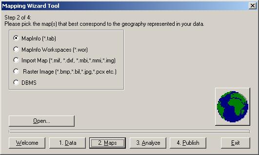
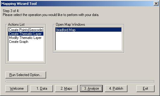
- 2. Maps: Choose the table where the geographical data for the map you want to make is stored. This may be a MapInfo table (.tab), a MapInfo workspace (.wor), or imported map (.mif and others), a raster image such as a bitmap (.bmp) or .jpg, or a DBMS file.
 If you are using the same table as above, miss out this stage and go straight on to stage 3, Analyse. If you are using the same table as above, miss out this stage and go straight on to stage 3, Analyse.
|
|
|
|
|